Liberia, officially English Republic of Liberia [r ɪ p ʌ bl ɪ k əv la ɪ b ɪ əriə], German Republic, Liberia country in West Africa, with (2019) 4.9 million residents; The capital is Monrovia.
Location
Liberia borders the Atlantic Ocean in the southwest, Sierra Leone in the northwest, Guinea in the north, and the Ivory Coast in the east.
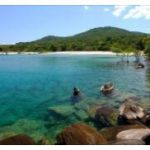
The natural spatial division is characterized by the gradual rise from the coast into the mountainous interior. At the same time, the deeply cut valleys of the rivers Saint Paul and Cestos cause a division into the heavily forested west, the more populated and cultivated central area and the huge, almost deserted forest area in the east. The 570 km long, barely indented compensation coast (former “pepper coast”) is characterized by the numerous diabase cliffs, mangrove swamps, lagoons, beach ridges, Spits and the violent surf (Calema) difficult to access. The 10–50 km wide, swamp and water-rich coastal plain usually remains below 50 m above sea level and is often covered at the edge with Cenozoic sea deposits (mangrove sands, sandstones). It merges with a level of terrain indicated by numerous rapids in the rivers into the deformed hull area of the inner plateau and hill country (200–400 m above sea level). This is made up of 80% gneisses and granites, which are superficially transformed into red earth. In the northeast the Nimbaberge run out (about 1,384 m above sea level in Liberian territory), the northern low mountain ranges reach the highest heights in the Wologisi Range (in Mount Wuteve 1,440 m above sea level).
Climate
Liberia has a sub-equatorial climate. The central and northern parts of the country have a rainy season (beginning of June to the end of October), in the northern part of the coast (north of Buchanan ) the rainy season is interrupted by a dry period in August. In the extreme south there are two rainy seasons (May – June, September – October). The total annual rainfall on the coast is 4,600 mm and falls steadily inland to around 1,900 mm near Suakoko, then increases again in the northern low mountain ranges (3,150 mm in the Nimba). The mean temperature on the coast is 26 ° C, the daily extreme values are 33 ° C and 16 ° C. In the interior of the country there are larger amplitudes during the year and during the day; temperatures can rise to 44 ° C (in Tapeta) and during the Harmattan period (December – January) drop to 11 ° C. The relative humidity is high (in Monrovia 85%), as is the water temperature on the coast (average 26.8 ° C). Short, violent thunderstorms in spring and autumn mark the change between southwest monsoon and northeast trade wind.
Vegetation
The tropical rainforest that originally dominated the whole country shows strong anthropogenic changes in the coastal strip (forest-savannah mosaic), in the northern mountainous region (moist savannah with elephant grass ) and in the central part (rubber plantations). About 44% of Liberia’s land area is forested. Due to heavy clearing and agriculture, the forest landscape is changing in places to the savannah landscape.
Buchanan
According to ejinhua, Buchanan [English bju ː kænən], is the port city on the coast of Liberia with 50 200 residents. County Grand Bassa administrative seat; End of the railway from the iron ore mines in the Nimbabergen; Ore processing and export; Airport.
Monrovia
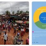
Monrovia, capital of Liberia, on the Gulf of Guinea, with (2008) 1.0 million residents; the most important free port in Africa.
Monrovia was founded in 1822 by freed slaves from the USA and named in 1824 after the American President James Monroe (1758-1831).


